

SRIHARIKOTA— Marking a landmark in space cooperation, the NASA-ISRO Synthetic Aperture Radar (NISAR) satellite has been successfully launched from the Satish Dhawan Space Centre on July 30, 2025.
The advanced radar satellite, jointly developed by NASA and the Indian Space Research Organisation (ISRO), carries a mission cost of $1.5 billion and aims to enhance global Earth monitoring capabilities.
This historic launch represents the first collaborative hardware mission between the U.S. and Indian space agencies.
NISAR is equipped with state-of-the-art dual-frequency radar technology that will allow scientists to monitor changes in land, ice, and vegetation with unmatched precision—critical for disaster forecasting and climate research.
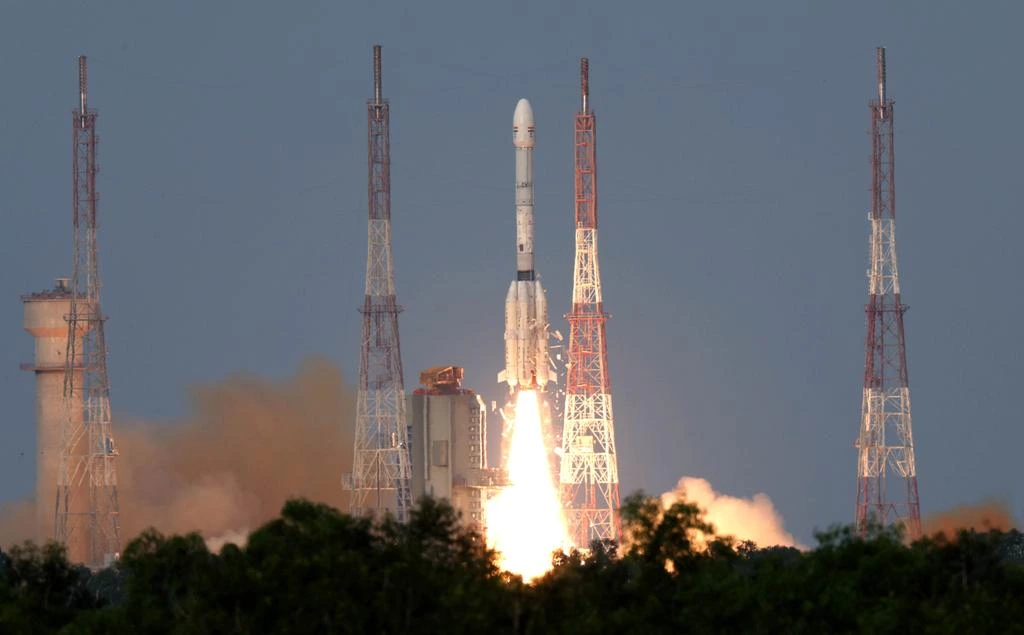 Photo: NASA
NASA-ISRO NISAR Satellite Takes off
NISAR is the first Earth-observation mission to use a dual-band synthetic aperture radar payload, integrating both L-band and S-band frequencies. The L-band radar, developed by NASA, uses a 25 cm wavelength ideal for monitoring vegetation, ice sheets, and land movement.
ISRO’s S-band radar, with a 10 cm wavelength, is designed to detect finer-scale changes in Earth’s surface, such as soil moisture or urban infrastructure deformation.
Working together, these systems deliver high-resolution data by synchronizing radar pulses in both time and location, enabling researchers to identify subtle surface movements and conditions across diverse environments.
The satellite’s cloud-penetrating radar technology ensures constant Earth monitoring, even during adverse weather.
NISAR’s target outcomes include early warnings of earthquakes, landslides, volcanic activity, and floods. The ability to capture surface deformations invisible to the naked eye makes it a transformative tool for risk assessment and response planning worldwide.
 Photo: NASA
Engineering and Deployment Capabilities
Roughly the size of a pickup truck, NISAR’s body houses an innovative gold-mesh antenna reflector, measuring 39 feet (12 meters) wide when deployed. This reflector operates like a giant radar dish, sending microwave signals to Earth and receiving the returned echoes.
The satellite, weighing over 5,000 pounds (2,270 kg), is powered by dual 18-foot solar arrays and launched into a near-polar orbit, approximately 464 miles (747 km) above Earth. This orbit allows global coverage, especially of polar and tropical regions where ice dynamics and vegetation changes are most critical.
The initial 90-day phase will focus on full system deployment, calibration, and testing. The primary scientific mission is scheduled for three years, but it carries enough onboard fuel for an extended operation of up to five years.
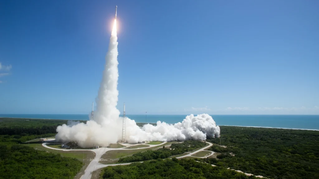 Photo: NASA HQ PHOTO
Climate, Disaster, and Infrastructure Monitoring
One of NISAR’s core goals is to advance the understanding of Earth’s carbon cycle, ice dynamics, and tectonic shifts. It will track deforestation, permafrost melting, and wildfire impacts—factors that significantly influence greenhouse gas emissions.
It will also help monitor dams, roads, and bridges for surface shifts, supporting civil infrastructure planning and maintenance. During weather-related disasters, NISAR’s ability to detect flood zones through cloud cover can aid emergency teams in planning more effective rescue operations.
NASA has termed NISAR “a model for the next generation of Earth-observation capabilities,” reflecting its multi-domain use for scientists, engineers, and emergency responders.
Stay tuned with us. Further, follow us on social media for the latest updates.
Join us on Telegram Group for the Latest Aviation Updates. Subsequently, follow us on Google News
NASA and FAA Developing New Technology to Suppress WildFire
The post NASA-ISRO Launches $1.5Bn, NISAR, Most Expensive Satellite in the World appeared first on Aviation A2Z.